Foreword Aerial drones are an important tool for us to conduct roof surveying and image recording. Therefore, the correct use of aerial drones can greatly improve our work efficiency.
Three elements are required for aerial photography roofs:
Top view, reference dimensions and roof inclination
The top plan view of the roof without distortion. The plane must fly to a sufficient height to ensure that the picture in the center of the lens is not distorted.

Figure 1
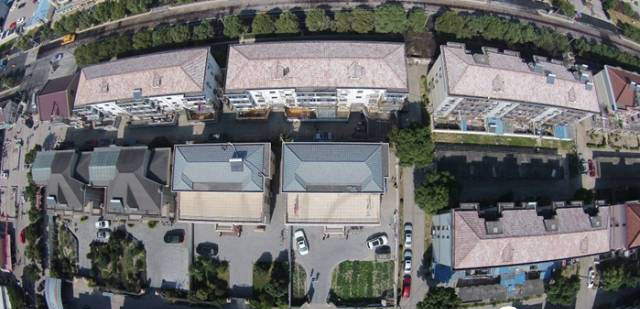
Figure 2
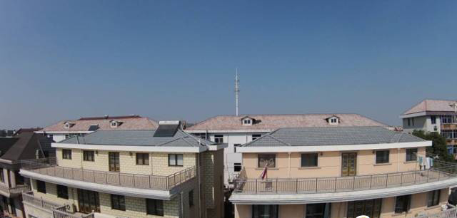
As shown in the figure, due to the large roof, the picture obtained at a height of 50 meters has large distortion, which is very unfavorable for surveying and mapping. Therefore, it is necessary to fly the aircraft to an altitude of 150 meters to obtain the aerial image of Figure 2.
The important reference size of the roof Because the height of each aerial image is inconsistent, the height of the roof is also inconsistent. Therefore, each measured roof needs a standard reference size. Therefore, a size equal to the height of the roof must be measured, which can be measured on the ground, The accuracy is accurate to 5cm.
Inclined roof angle
Since the top view of the roof is the projection distance, it is also necessary to know the inclination of the roof, which can be obtained by photographing the roof from the side.
Arrangement design
With the front view of the project and the benchmarking reference size, you can quickly organize the layout in the design assistant software.

You Might Also Like